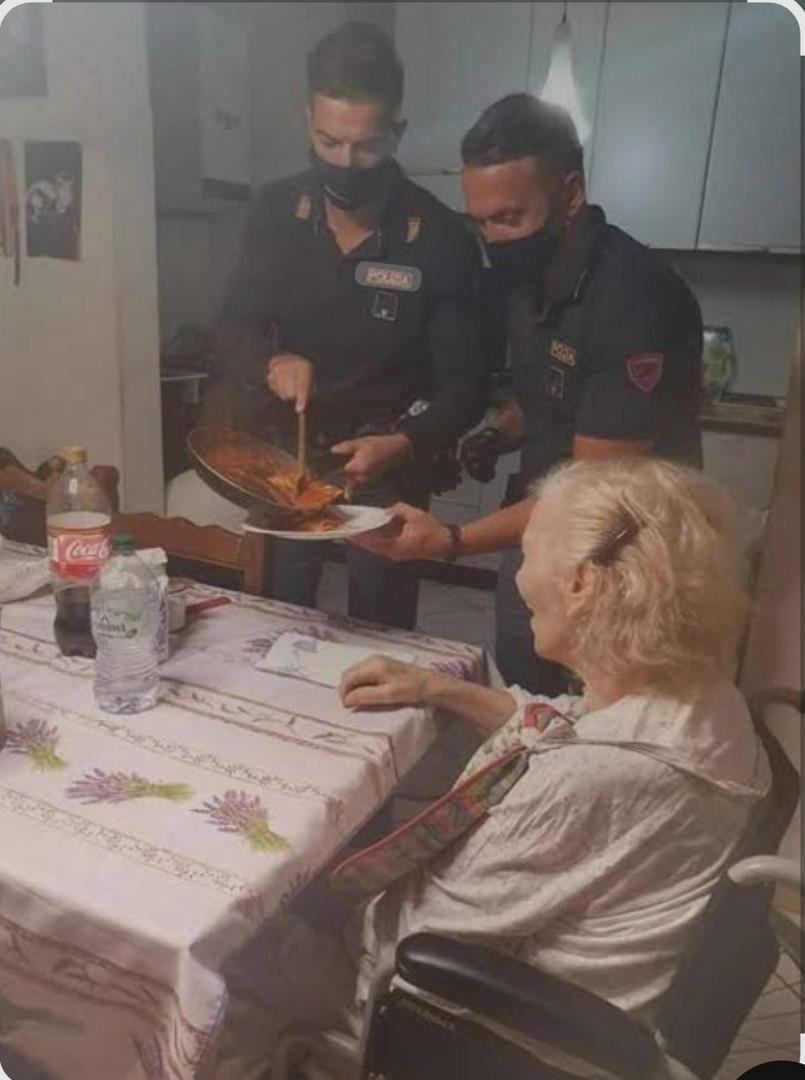
2 Police 🚓 🚨 officers in Italy were dispatched to an 87 year olds house, because she called 911 and said she was lonely and hungry obviously they had to go, just in case it was a serious situation. They arrived and it was exactly what she said...so they came up with an Idea and cooked her pasta and sat down with her and ate a small meal together...Just a beautiful story of 2 caring humans who came out and served a lady in there town, ya know protect and serve. We sometimes forget the serve part..in the comments people were arguing about this and how in there state this would never happen and on and on, my response was this.... what's yours? Are we seriously grown adults playing the na ah game.....can't we just celebrate what those police officers of the law, did for that lady. Forget about the country, and the language, and location. At the end of the day, it's just 3 humans. 2 were police officers, and one was an 87 year old lady. In any country, or state, or territory in the world, no police officer, would get in trouble for serving others, especially a lonely 87 year old grandmother. They Protect and Serve. And that was serving a lady, in there community the best they knew, and probably the first time they had done that before, let's stop arguing about how it happened or where, and just celebrate a special Moment.