1/1
Unlocking Canada: The Secret to Memorizing Provinces & Territories
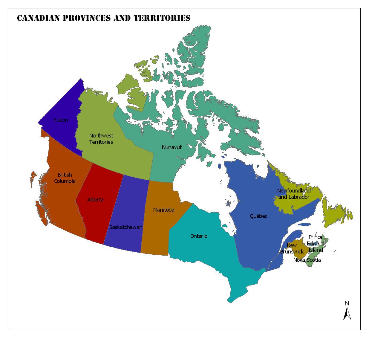
Ever stared at a map of Canada and felt your brain freeze faster than a Yukon winter? I’ve been there, friend! With ten provinces and three territories, it’s easy to get lost in the snowdrift of names. But let me share my quirky tricks that transformed my confusion into confidence. 🌨️ First, I visualized the bottom row: British Columbia, Alberta, Saskatchewan, Manitoba, Ontario, Quebec, and Newfoundland. I whispered the odd word 'BASMOQN' (sounds like a wizard’s spell, right?) and made up wild mnemonics like, “Bill and Sally Made One Quart of Nothing.” Then, I tackled the top: Yukon, Northwest Territories, and Nunavut—YNN. I giggled at “You’re Not Naked” (hey, whatever works!). Finally, the southeast triangle: Prince Edward Island, Nova Scotia, and New Brunswick. Picture a triangle—PEI at the top, Nova Scotia to the right, New Brunswick to the left. I won’t pretend I’m perfect—sometimes I still mix up Manitoba and Saskatchewan! So, what’s your best mnemonic? Or did I miss a trick? Drop your wisdom below and let’s conquer Canada together! 🍁😂 Let’s build a memory map—one comment at a time! #GeographyHacks #StudyTips #Canada #Education
2025-06-06
write a comment...