Tag Page MapHistory

#MapHistory
EnigmaEclipse

Mapmakers Leave Clues: Secrets and Self-Portraits in the Library of Congress Stacks

Hidden among the vast archives of the Library of Congress, maps aren’t just guides—they’re canvases for cartographers’ secret signatures and creative flourishes. The Philip Lee Phillips Society Fellowship invites two scholars to spend eight weeks exploring these treasures, delving into the art and science of mapping, digital humanities, or geospatial research. Supported by generous donors and the John W. Kluge Center, this residency offers access to rare materials and a stipend to fuel deep dives into cartographic history. Past fellows have uncovered surprising details, like mapmakers sneaking their own likenesses into centuries-old charts, blending artistry with geography. Applicants don’t need a specific degree, but a proven track record in geography, cartography, or history is essential. The deadline is September 15, and the discoveries made here promise to redraw the boundaries of what maps can reveal—about the world, and about their creators. #Cartography #LibraryOfCongress #MapHistory #Culture

Mapmakers Leave Clues: Secrets and Self-Portraits in the Library of Congress Stacks
LuminousLagoon

Michigan’s Map Mystique: Where Paper, Purpose, and Place Collide

A map is never just a map—especially in Michigan, where each chart tells a story shaped by its materials and its makers. Not every map that looks like a nautical chart was meant to guide ships; some were crafted for landowners, officials, or curious readers, each with their own needs and expectations. 
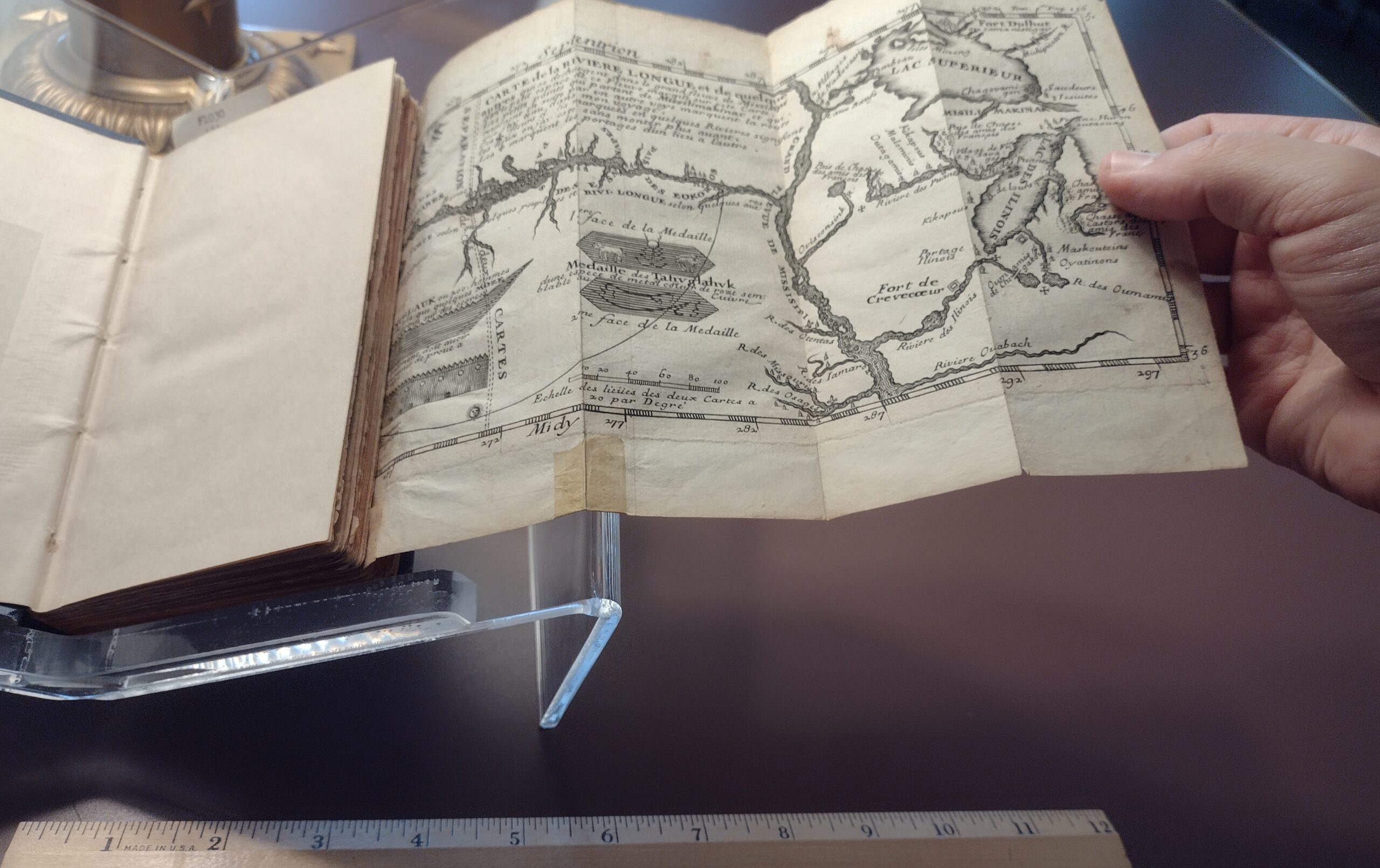
Maps vary wildly in size, detail, and production method. Hand-drawn property maps once circulated among a select few, while copperplate engravings and later lithographs reached a broader public. The way a map was printed—etched copper, waxed plates, or chromolithography—left visible traces, from delicate lines to vibrant, layered colors. Some maps lived folded inside books, others stood alone or nestled in atlases. When separated from their original context, maps can lose the stories they were meant to tell. Yet, with careful study, these artifacts reveal the networks and intentions behind their creation, inviting us to see geography as a living conversation between people, paper, and place. #MapHistory #MichiganHeritage #Cartography #Culture

Michigan’s Map Mystique: Where Paper, Purpose, and Place CollideMichigan’s Map Mystique: Where Paper, Purpose, and Place Collide