Tag Page OutdoorExploration

#OutdoorExploration
Robin Nichols

Castle Rock State Park: Hiking Adventures!

Section 1: Hidden Beauty Nestled above San Jose, Castle Rock State Park is a captivating hidden gem that often goes unnoticed. Its promise of climbing opportunities amidst colossal rocks drew me in for a short 1.5-mile hike to Castle Rock and the Castle Rock Falls Overlook. Section 2: Exploring the Trail Off Highway 35, I found myself welcomed by a small parking lot. The $8 fee felt like a small investment in preserving this hidden sanctuary. As I embarked on the Castle Rock Trail, a shaded quarter-mile path, a picturesque landscape of trees and moss surrounded me, creating a tranquil atmosphere. Section 3: Discovering Castle Rock Navigating a dirt road and turning right, I encountered various rocks, initially unsure if I had reached Castle Rock. Fortunately, guidance from a fellow adventurer who was teaching his son to climb confirmed that I was in the right place. Castle Rock stood majestically before me, with its intricate features including expansive caves, inviting me to explore for a solid 15 minutes. I couldn't help but feel the desire to return for more climbing adventures. Section 4: Chasing Waterfalls Though the dirt offshoots occasionally confused the trail, I trusted the well-trodden path and eventually reached the Saratoga Gap trail sign. Taking a left turn, I descended alongside a babbling creek, treating my eyes to enchanting views through the trees. Crossing a quaint bridge, it didn't take long for me to reach the Castle Rock Falls Overlook. While the waterfall might not always steal the spotlight, its charm becomes undeniable after rainfall. Section 5: A Hidden Gem Castle Rock State Park truly exceeded my expectations. Happy trails, fellow adventurers! May your journeys be filled with wonder as you explore this hidden gem. #CastleRockStatePark #HikingAdventures #NaturesBeauty #OutdoorExploration #HiddenGem #WaterfallWonder #ClimbingOpportunities #TranquilityInTheWild #HappyTrails #NatureLovers

Castle Rock State Park: Hiking Adventures!Castle Rock State Park: Hiking Adventures!Castle Rock State Park: Hiking Adventures!Castle Rock State Park: Hiking Adventures!Castle Rock State Park: Hiking Adventures!
Mrs. Andrea Ayala

Reinhardt Redwood Regional Park Hiking ๐ŸŒฒ๐Ÿšถโ€โ™‚๏ธ

Hard to believe this beautiful gem is only about 20-30 mins from downtown Oakland! ๐Ÿ˜ฎ Discover the enchanting beauty of Reinhardt Redwood Regional Park on this hiking adventure. Hike information: ๐Ÿ“‹ ๐Ÿ…ฟ๏ธ Free parking at Skyline Gate Staging Area ๐Ÿฅพ Take West Ridge Trail to Tres Sendas Trail, then explore the "ancient trees" section of Stream Trail, before returning to the parking lot along Stream Trail. ๐Ÿƒ The hike covers approximately 4.3 miles of scenic trails. โ›ฐ๏ธ Be prepared for an elevation gain of around 580 ft. ๐Ÿถ Enjoy the most dog-friendly hike ever! Reinhardt Redwood Regional Park has designated off-leash sections, making it a perfect outing for your furry friend. ๐Ÿ• So grab your hiking boots and get ready for a memorable adventure amidst the towering redwoods and picturesque landscapes! ๐ŸŒณ๐ŸŒฟ #ReinhardtRedwoodPark #Hiking #NatureAdventures #OaklandTrails #DogFriendlyHike #RedwoodForest #ScenicTrails #OutdoorExploration #BayAreaLife #HappyHiking

Reinhardt Redwood Regional Park Hiking ๐ŸŒฒ๐Ÿšถโ€โ™‚๏ธReinhardt Redwood Regional Park Hiking ๐ŸŒฒ๐Ÿšถโ€โ™‚๏ธReinhardt Redwood Regional Park Hiking ๐ŸŒฒ๐Ÿšถโ€โ™‚๏ธReinhardt Redwood Regional Park Hiking ๐ŸŒฒ๐Ÿšถโ€โ™‚๏ธ
Christian Russo

Bay Area Discovery Museum: Fun Place for Toddlers to Burn Engergy

The Bay Area Discovery Museum is the perfect destination for little ones to explore, learn, and play. With its stunning location on the water in Sausalito, this interactive museum offers a wide range of exhibits and activities designed specifically for toddlers. Here are some highlights of what the Bay Area Discovery Museum has to offer: ๐Ÿ”ต Tot Spot: This dedicated space for children ages 0-4 is a safe and engaging environment where little ones can crawl, climb, and discover. From a sensory garden to a soft play area, Tot Spot is guaranteed to keep your toddler entertained. ๐Ÿ”ต Outdoors: The museum's outdoor spaces provide endless opportunities for toddlers to run, jump, and explore. From the Lookout Cove, where they can dig in the sand and splash in the water, to the Discovery Pond, where they can go on a nature scavenger hunt, there's something for every adventurous tot. ๐Ÿ”ต Art Studios: Let your toddler unleash their creativity in the art studios. From painting and sculpting to collage-making, these hands-on activities are sure to inspire their imagination. ๐Ÿ”ต Exhibits: The museum features a variety of exhibits that engage children in STEM learning. From the Imagination Playground, where they can build and create, to the Bay Hall, where they can learn about marine life, there's no shortage of educational experiences. ๐Ÿ”ต Programs: The Bay Area Discovery Museum offers a range of programs specially designed for toddlers and their caregivers. From story times to music classes, these interactive sessions provide a chance for little ones to learn and socialize. #BayAreaDiscoveryMuseum #Toddlers #FunActivities #InteractiveLearning #Sausalito #FamilyFun #OutdoorExploration #Creativity #STEM #Playtime

Bay Area Discovery Museum: Fun Place for Toddlers to Burn EngergyBay Area Discovery Museum: Fun Place for Toddlers to Burn EngergyBay Area Discovery Museum: Fun Place for Toddlers to Burn EngergyBay Area Discovery Museum: Fun Place for Toddlers to Burn EngergyBay Area Discovery Museum: Fun Place for Toddlers to Burn EngergyBay Area Discovery Museum: Fun Place for Toddlers to Burn EngergyBay Area Discovery Museum: Fun Place for Toddlers to Burn EngergyBay Area Discovery Museum: Fun Place for Toddlers to Burn EngergyBay Area Discovery Museum: Fun Place for Toddlers to Burn Engergy
Mrs. Andrea Ayala

๐ŸŒพ๐Ÿ‚ California Autumn: The Reeds on the Beach ๐ŸŒพ๐Ÿ‚

Looking to embrace the autumn vibes in California? Go hiking and immerse yourself in the enchanting beauty of the reed fields! Picture an entire valley covered in fields of swaying reeds, resembling waves of feathers. It's a truly magical and romantic experience. Here's everything you need to know about finding and enjoying the vast expanse of reeds on the beach:
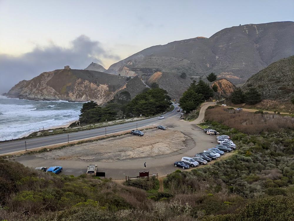
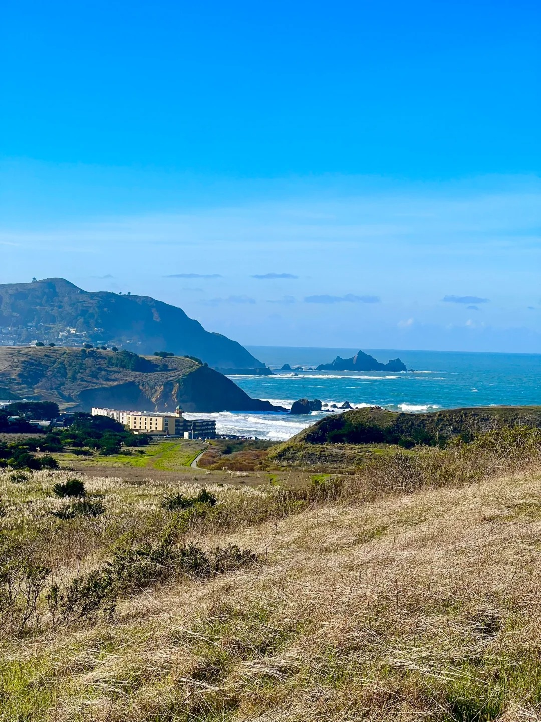
 ๐Ÿ“ Location: Pacifica Quarry Running Trail, 4600 Pacific Coast Hwy, Pacifica, CA. ๐Ÿ…ฟ๏ธ Parking: There is a small parking lot at the trail entrance, but it tends to fill up quickly on weekends. Alternatively, you can park across the street at the plaza. Finding the Reed Fields - 
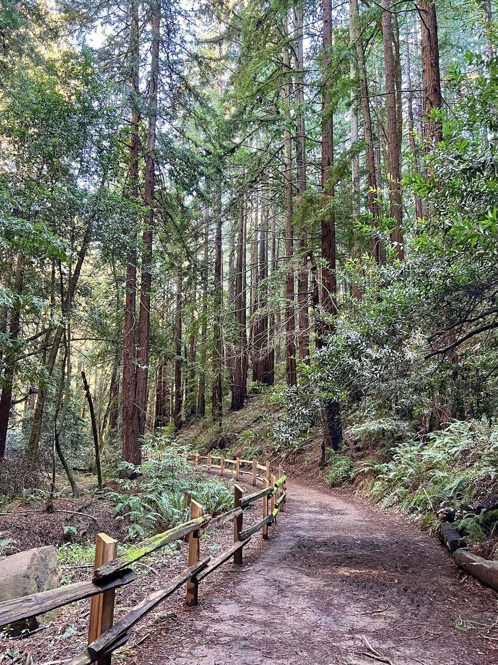
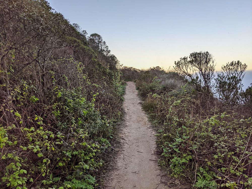
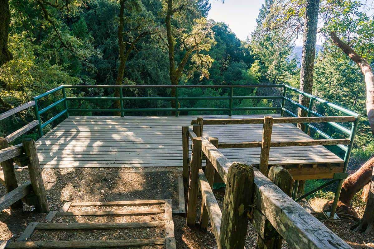
Upon arriving at the trail entrance, you'll see a large iron gate. Behind the gate, three paths await you: a dirt road to the left, another dirt road straight ahead, and a bike lane to the right. - 
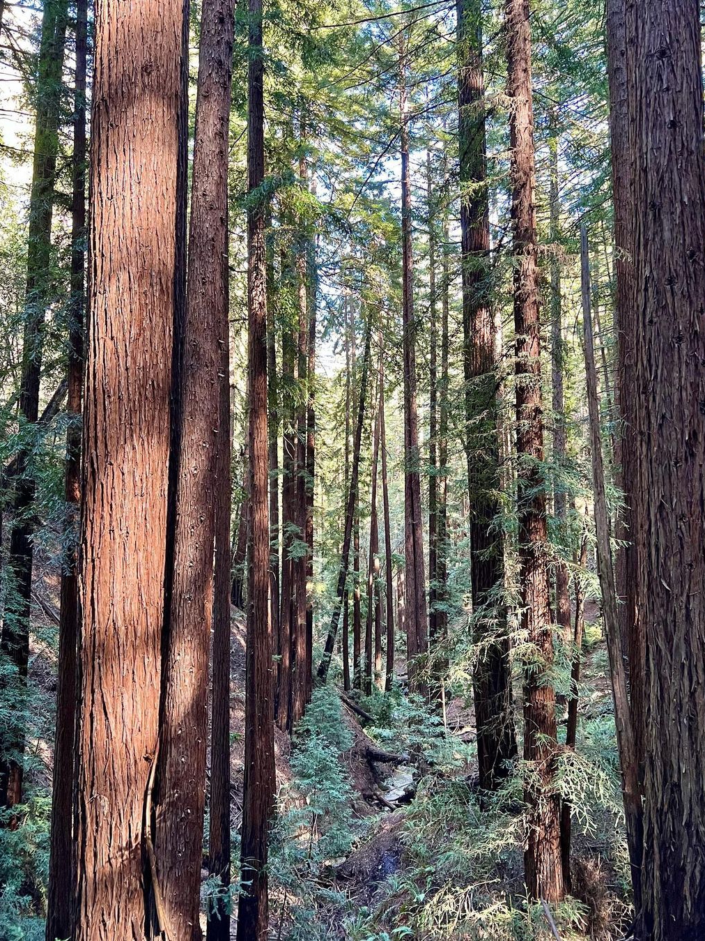
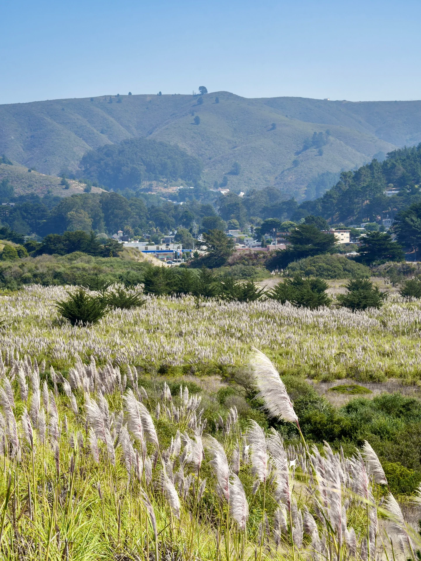
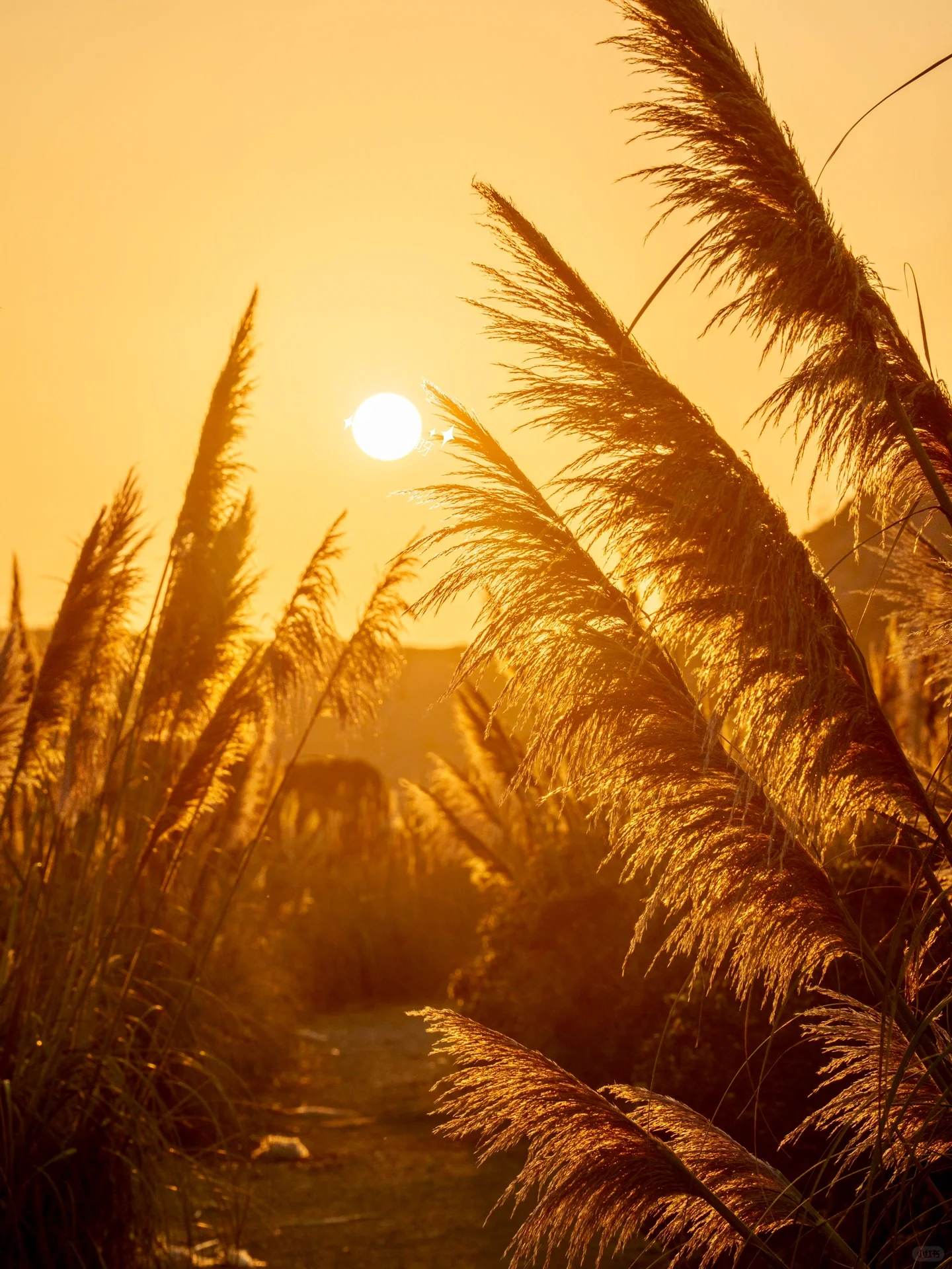
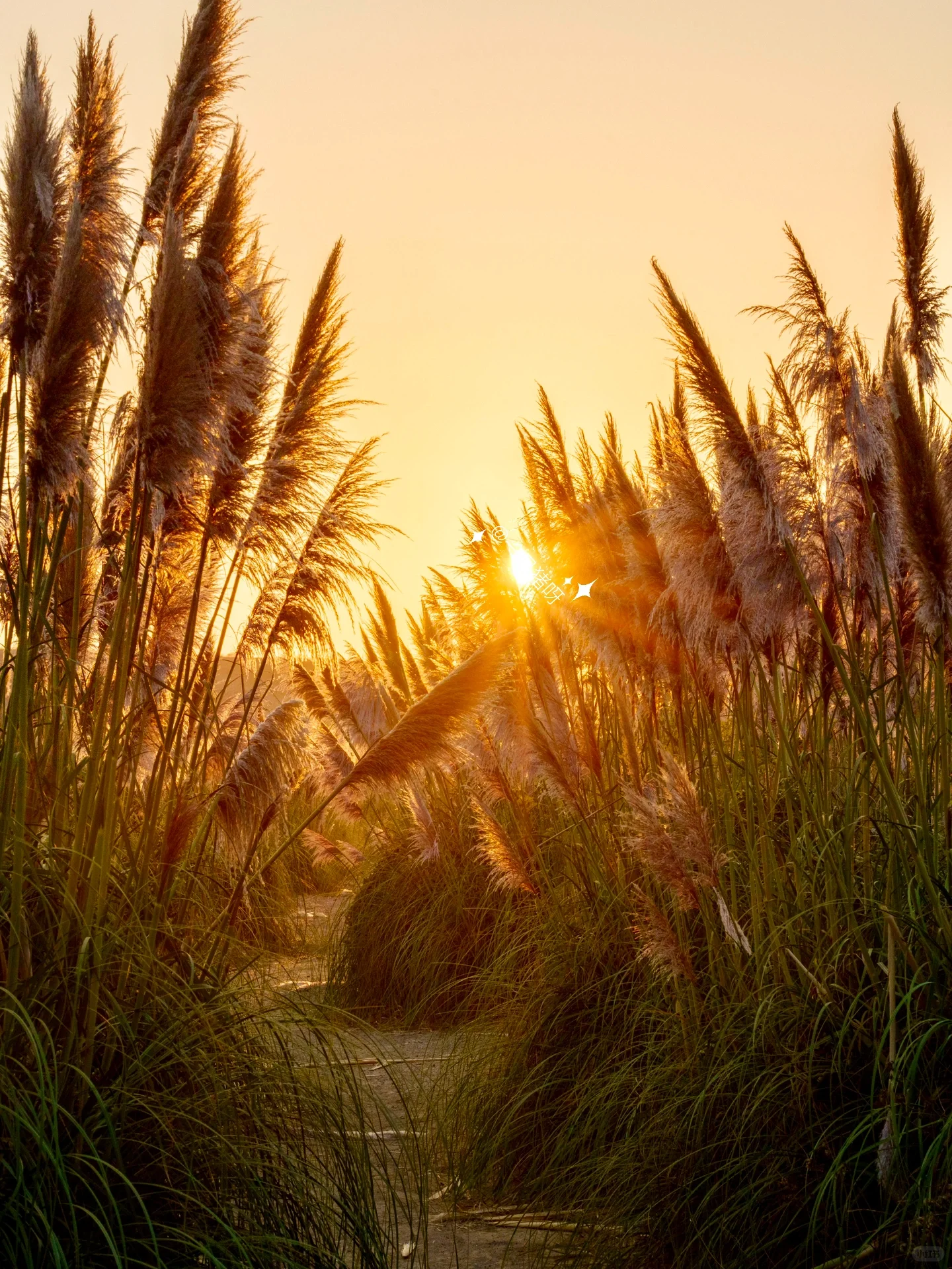
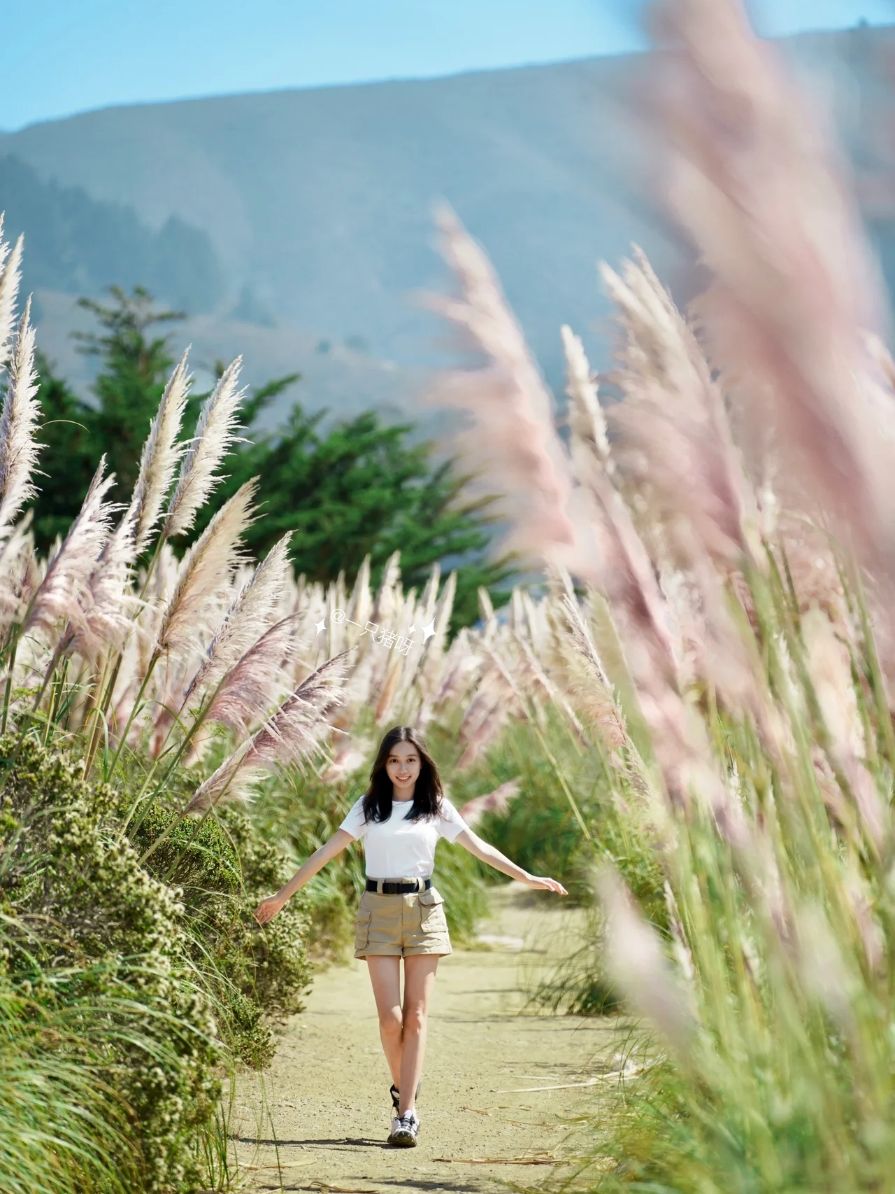
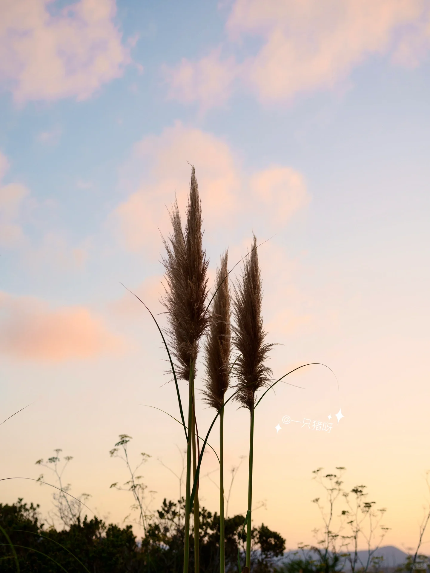
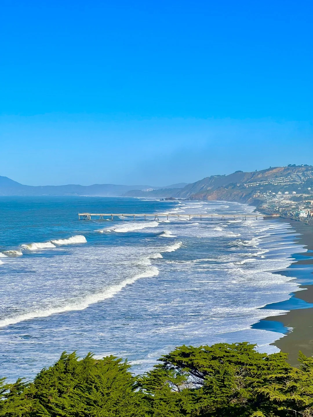
Take the wide dirt road straight ahead, and within a 5-minute walk, you'll find yourself surrounded by a sea of reeds (see pic 1). These tall and dense reeds are perfect for capturing stunning portraits. The path here is spacious and flat, making it easy to walk even without athletic shoes. - On the right-hand side, there is a paved road suitable for biking or jogging. This path also features a charmingly arranged roadside garden. Exploring the Trail - 
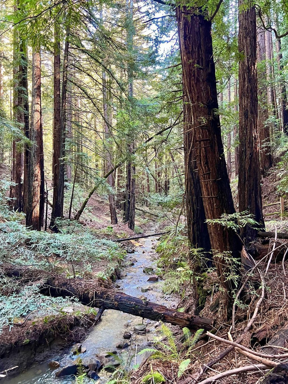
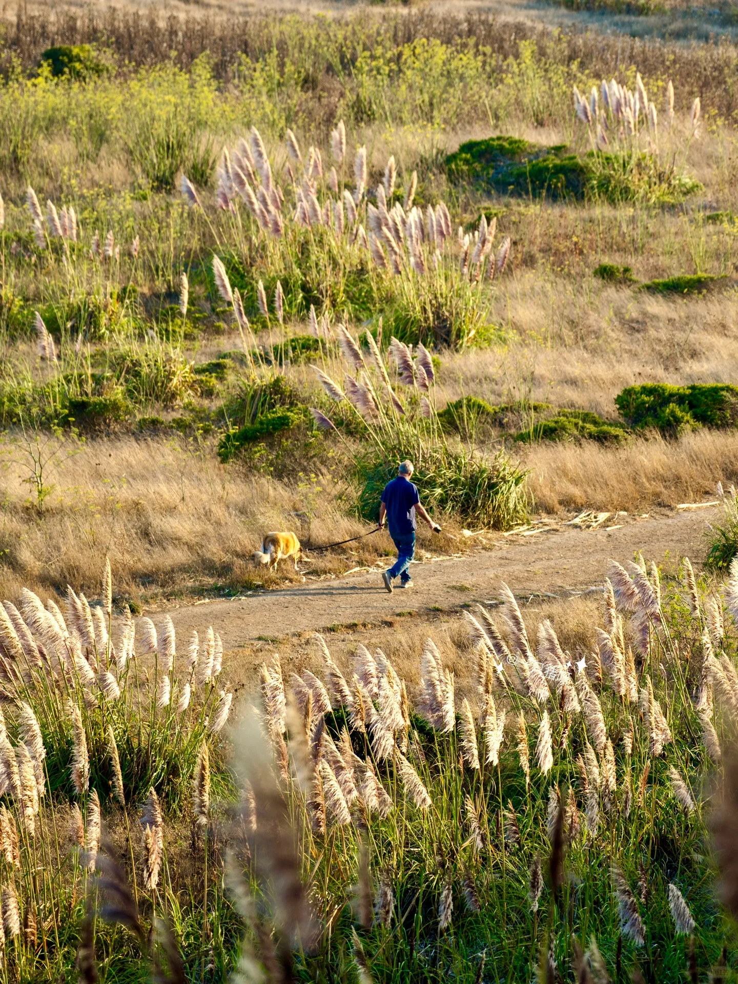
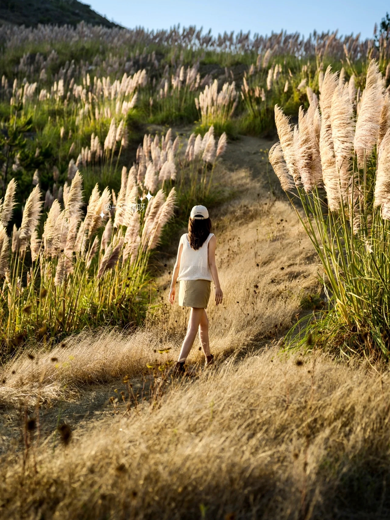
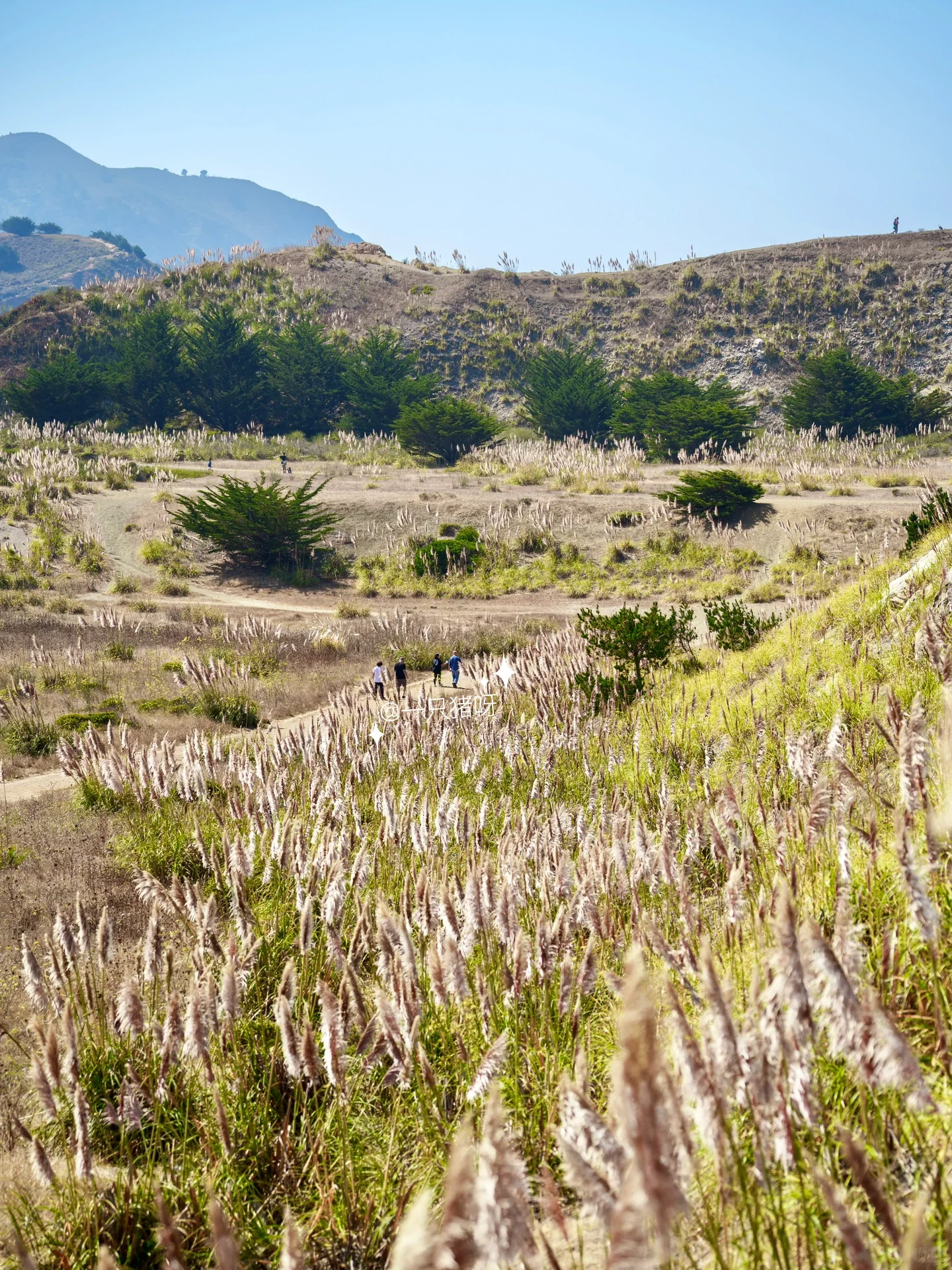
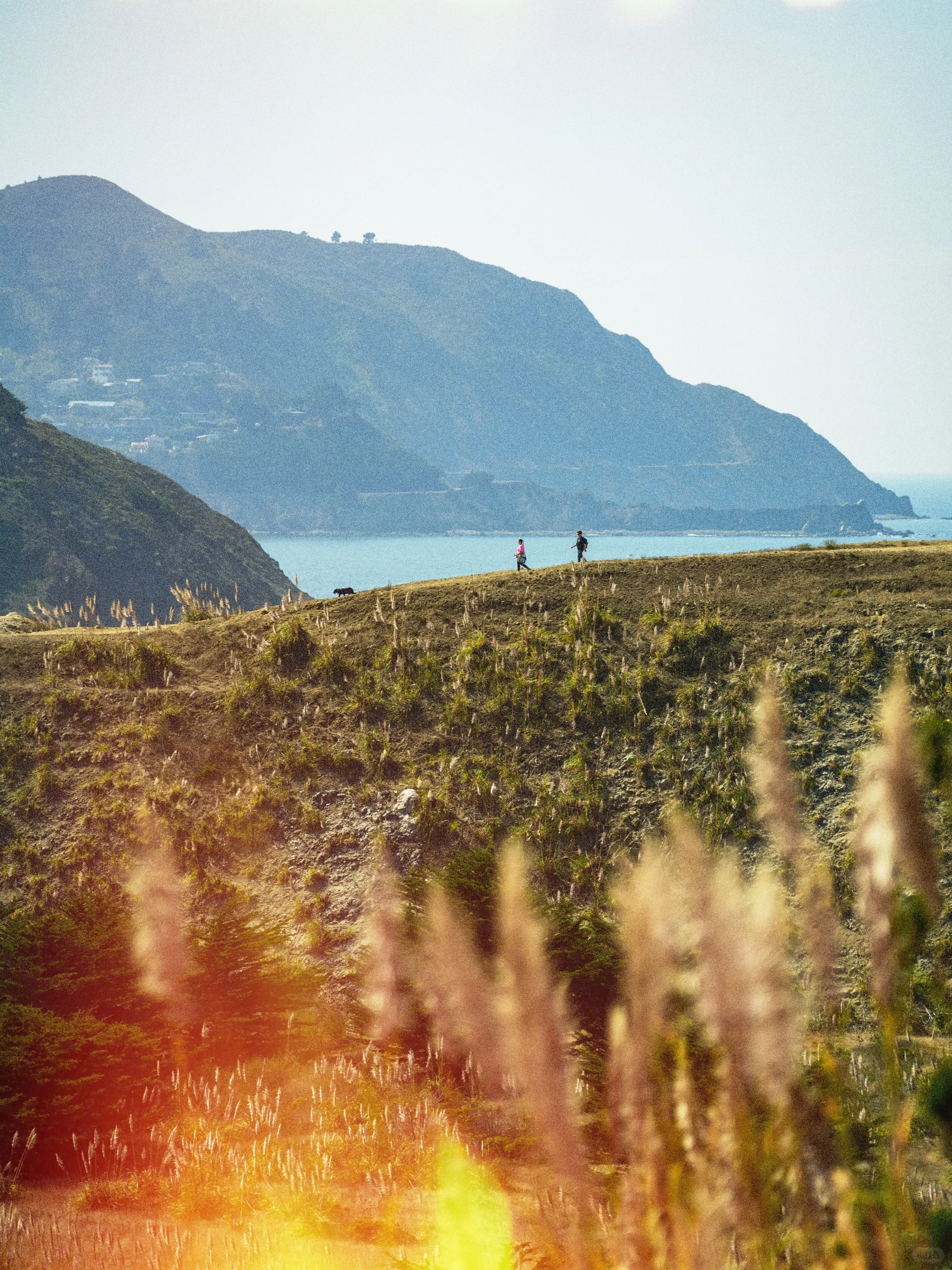
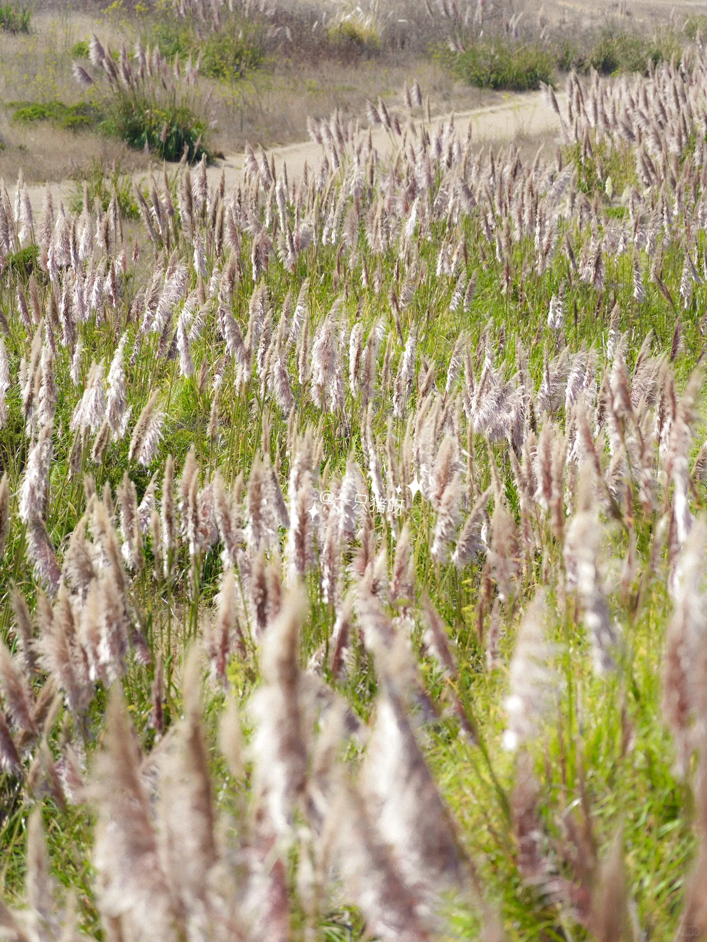
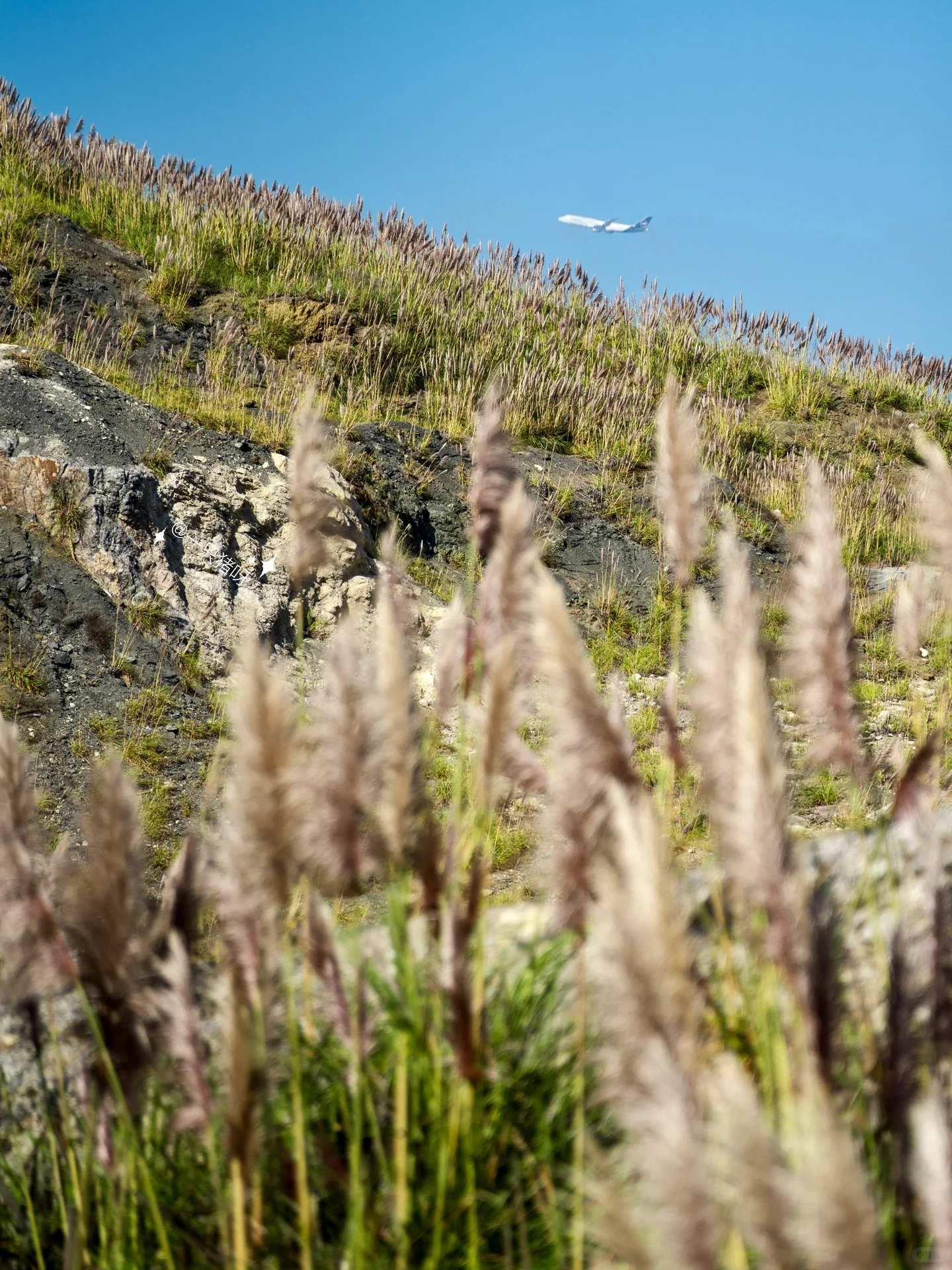
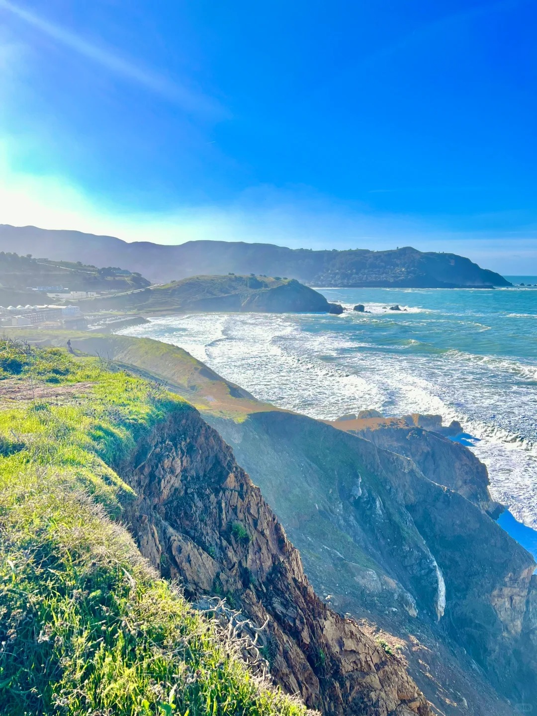
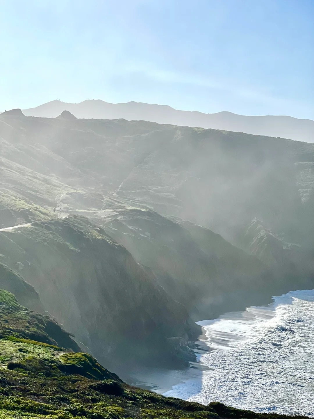
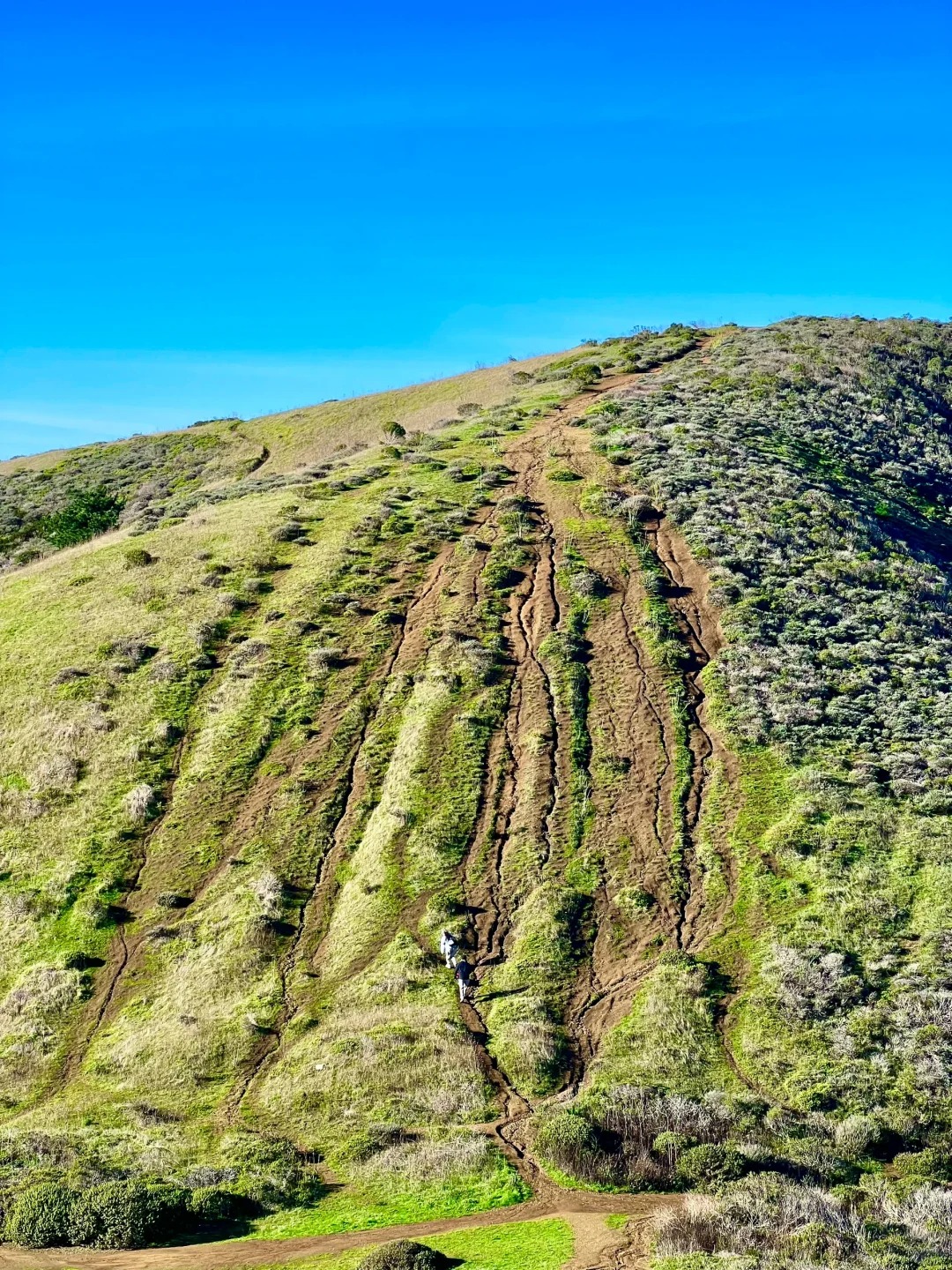
As you continue along the trail for approximately 15 minutes, you'll reach a fork in the road. Taking the right turn will lead you to a steep uphill path, where reeds beautifully cover the slopes. Be sure to wear proper athletic shoes for this section. - 
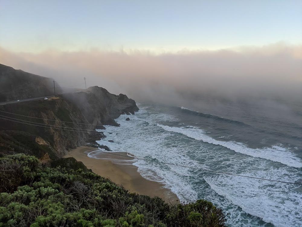
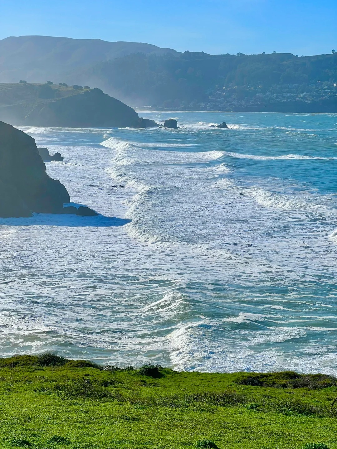
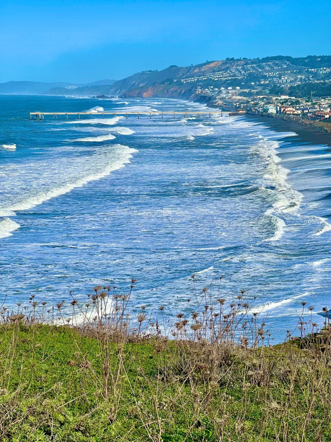
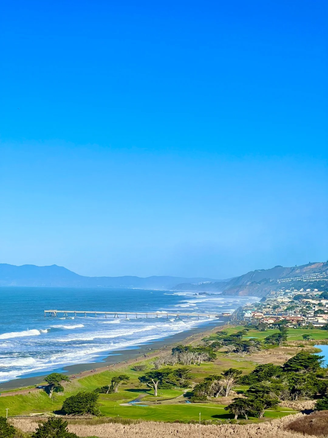
Continuing straight ahead will take you to a small hill leading to the beach. The reeds along this part of the trail are less dense, so photography opportunities may be limited. Trail Summary and Tips - The entire trail is approximately 0.7 miles long and can be completed in about 30 minutes. - Along the way, you may encounter several junctions. If you have the time, feel free to explore all of them. However, I recommend starting by taking the dirt road straight ahead to enjoy the stunning reed fields. After leaving the fields, venture onto the steep uphill path for a different perspective and breathtaking views. - 
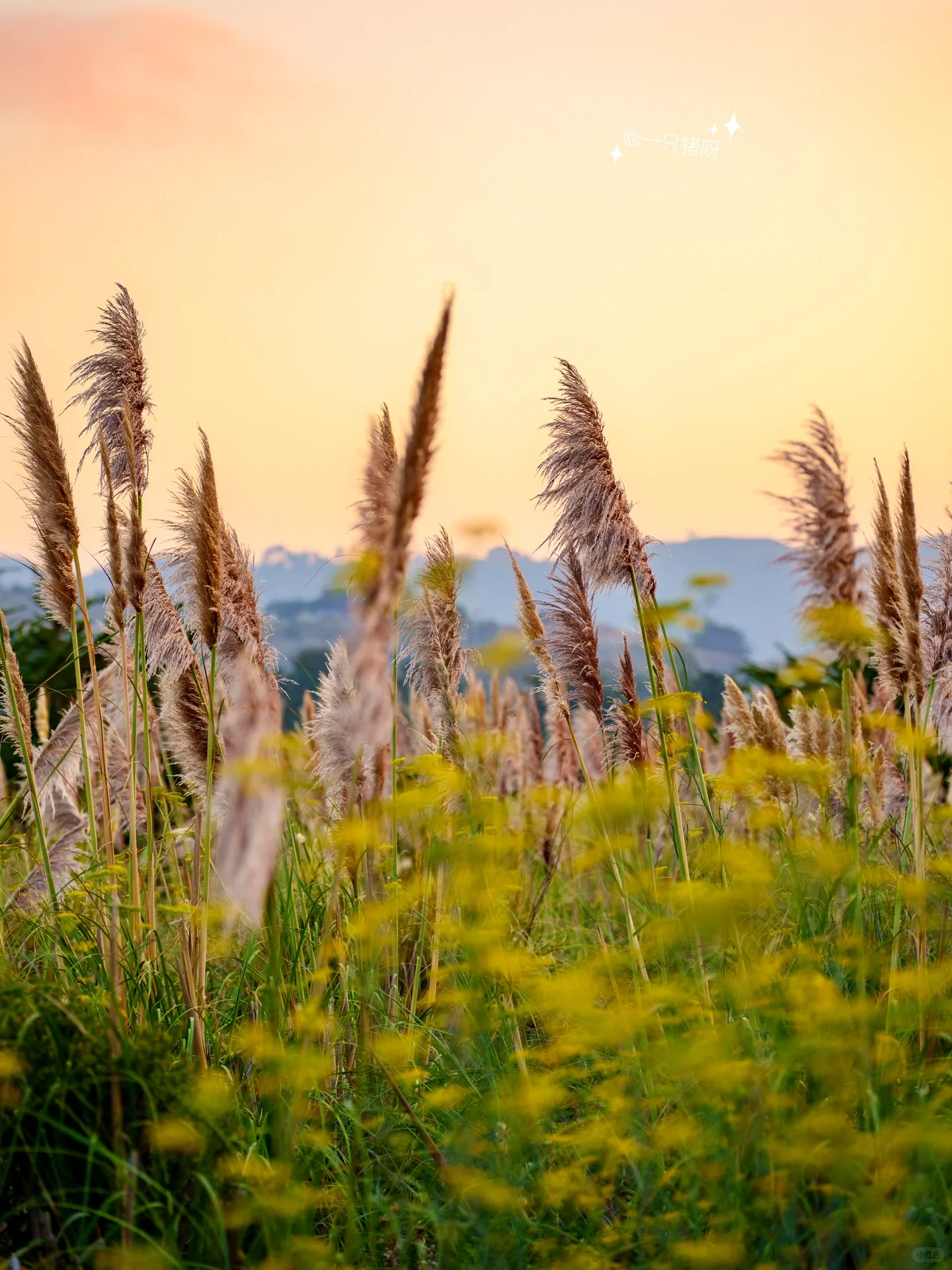
Currently, the reeds are not in full bloom yet. They appear as a purplish-brown color with a fuzzy texture. When in full bloom, they turn a pale white and become even more fluffy. Tips for the Visit - Plan your visit during the afternoon when the weather is generally warmer and more pleasant. Keep in mind that the trail is mostly surrounded by shrubs and reeds, offering little shade. Additionally, the beach is windy, so it's important to protect yourself from the wind and sun. - 
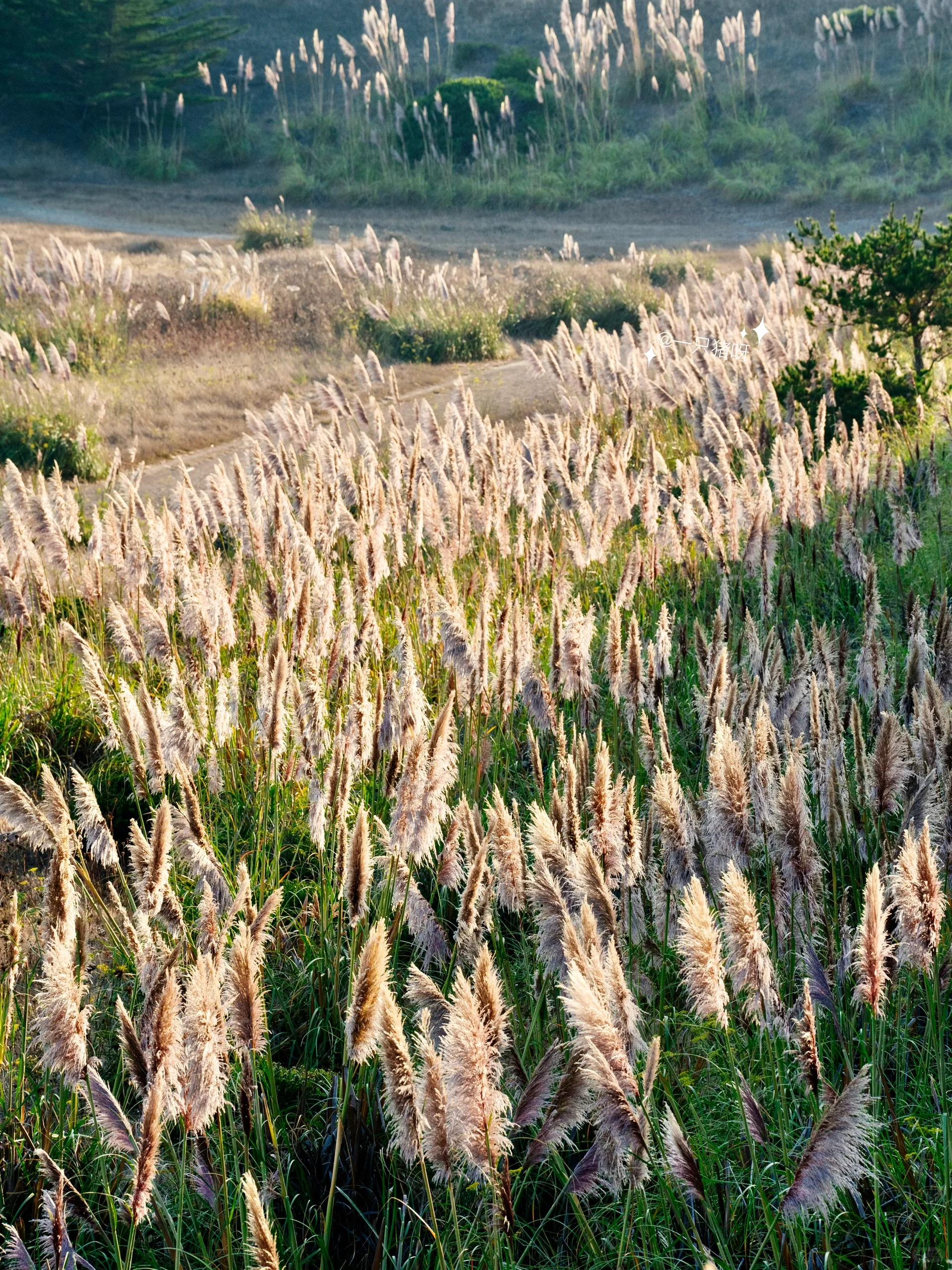
If you're interested in capturing stunning portraits, consider arriving about an hour before sunset. The backlighting combined with the golden hues of the sunset creates a dreamy and radiant atmosphere within the reed fields. ๐Ÿ“ Don't rely on the map, as the trail remains open all day. Remember to follow any safety guidelines and enjoy your peaceful and picturesque adventure at the reeds on the beach! ๐ŸŒพ๐Ÿ #CaliforniaAutumn #HikingAdventure #ReedFields #PacificaQuarryTrail #EnchantingNature #MagicalLandscapes #DreamyPhotography #OutdoorExploration #AutumnVibes #BeautifulCalifornia

๐ŸŒพ๐Ÿ‚ California Autumn: The Reeds on the Beach ๐ŸŒพ๐Ÿ‚๐ŸŒพ๐Ÿ‚ California Autumn: The Reeds on the Beach ๐ŸŒพ๐Ÿ‚๐ŸŒพ๐Ÿ‚ California Autumn: The Reeds on the Beach ๐ŸŒพ๐Ÿ‚๐ŸŒพ๐Ÿ‚ California Autumn: The Reeds on the Beach ๐ŸŒพ๐Ÿ‚๐ŸŒพ๐Ÿ‚ California Autumn: The Reeds on the Beach ๐ŸŒพ๐Ÿ‚๐ŸŒพ๐Ÿ‚ California Autumn: The Reeds on the Beach ๐ŸŒพ๐Ÿ‚๐ŸŒพ๐Ÿ‚ California Autumn: The Reeds on the Beach ๐ŸŒพ๐Ÿ‚๐ŸŒพ๐Ÿ‚ California Autumn: The Reeds on the Beach ๐ŸŒพ๐Ÿ‚๐ŸŒพ๐Ÿ‚ California Autumn: The Reeds on the Beach ๐ŸŒพ๐Ÿ‚๐ŸŒพ๐Ÿ‚ California Autumn: The Reeds on the Beach ๐ŸŒพ๐Ÿ‚๐ŸŒพ๐Ÿ‚ California Autumn: The Reeds on the Beach ๐ŸŒพ๐Ÿ‚๐ŸŒพ๐Ÿ‚ California Autumn: The Reeds on the Beach ๐ŸŒพ๐Ÿ‚๐ŸŒพ๐Ÿ‚ California Autumn: The Reeds on the Beach ๐ŸŒพ๐Ÿ‚๐ŸŒพ๐Ÿ‚ California Autumn: The Reeds on the Beach ๐ŸŒพ๐Ÿ‚
Christopher Gilbert

Conquer the Heights: Montara Mountain Hike for Stunning Views of Pacifica and Half Moon Bay!

There are lots of hiking trails that give you beautiful views across Pacifica and into Half Moon Bay, but if youโ€™re looking for a bit of a challenge to go along with it, you need to try the Montara Mountain hike next time you visit. ๐ŸŒฒ Here's what you need to know about this popular hike: โœ…There are three separate trailheads for this hike, providing parking alternatives. โœ… Dress in layers and wear sweat-wicking materials to handle changing temperatures. Don't forget shoes with good grip for the steep fire trail. โœ… Essentials to bring include sunscreen, hat, refillable water bottle, a picnic lunch, downloaded maps, a mask, a comfortable backpack, and a camera to capture the stunning views. ๐Ÿšถโ€โ™€๏ธ The Montara Mountain Hike: - Distance: 7.8 miles loop - Difficulty: Medium to difficult - Elevation: 1898 ft (578 meters) - Starting point: Gray Whale Cove Trail parking lot, Pacific Coast Highway, Pacifica ๐Ÿ” The Initial Climb: - Begin at Gray Whale Cove Trailhead, enjoying views of the Pacific Ocean and the coast. - Turn left onto North Peak Access Road to start the climb. - Marvel at panoramic views of Pacifica, the Farallon Islands, Mt Tamalpais, Point Reyes, Pillar Point, and Half Moon Bay. โ›ฐ๏ธ Reaching the Summit: - Note that the actual peak is fenced off due to a radio tower and weather station. But being close is still an achievement! - Visit the rain gauge, become a citizen scientist, and report the water levels. ๐Ÿšถโ€โ™‚๏ธ The Descent: - Retrace your steps down North Peak Access Road. - Take the narrow dirt trail for a change of scenery, passing through shrubs and shaded areas. - Descend a steep section to join Old San Pedro Mountain Road. - Return to the parking lot via Gray Whale Cove Trail, enjoying ocean views along the way. With stunning vistas and a challenging climb, the Montara Mountain hike is a must-try for nature enthusiasts in the Pacifica and Half Moon Bay area! ๐ŸŒฟ #MontaraMountain #Hiking #Pacifica #HalfMoonBay #Nature #Adventure #OutdoorExploration #BreathtakingViews #HikeCalifornia #ExploreTheOutdoors

Conquer the Heights: Montara Mountain Hike for Stunning Views of Pacifica and Half Moon Bay!Conquer the Heights: Montara Mountain Hike for Stunning Views of Pacifica and Half Moon Bay!Conquer the Heights: Montara Mountain Hike for Stunning Views of Pacifica and Half Moon Bay!Conquer the Heights: Montara Mountain Hike for Stunning Views of Pacifica and Half Moon Bay!Conquer the Heights: Montara Mountain Hike for Stunning Views of Pacifica and Half Moon Bay!Conquer the Heights: Montara Mountain Hike for Stunning Views of Pacifica and Half Moon Bay!
Christian Russo

Trail Recommendation | Chasing Giant Waves at Mori Point

๐Ÿ“ Location: Mori Point, Pacifica ๐Ÿž๏ธ Scenery: Giant waves, coastline, mountain views, and forests โญ๏ธ Difficulty: Moderate Mori Point, a hidden gem on the California coastline! If you're looking for an exhilarating adventure, look no further than wave-chasing at this breathtaking location. ๐ŸŒŠ๐Ÿคฉ Here are some important things to know before you go: ๐Ÿ…ฟ๏ธ Limited parking: Plan to arrive early as parking spaces are limited. The address is 651 San Marlo Way, Pacifica, CA 94044. Keep an eye out for the intersection to turn in from Highway 1, as it may not be very conspicuous. ๐Ÿšป Restroom facilities: Next to the parking area, you'll find a small plaza with restroom facilities for your convenience. โš ๏ธ Be cautious of steep paths: If you're following the AllTrails route, be aware that it may guide you onto some steep paths, especially after heavy rain when there might be numerous ravines. ๐Ÿ‘ฅ Follow the crowd: If you prefer an easier route, simply follow the crowd. There are often several options to choose from, ensuring a safe and enjoyable experience. So grab your camera and get ready for an awe-inspiring adventure at Mori Point. Don't miss out on the opportunity to witness the power of mother nature's giant waves! ๐Ÿ“ธ๐ŸŒŠ #MoriPoint #WaveChasing #CaliforniaCoastline #HikingAdventure #ScenicViews #OutdoorExploration #NaturePhotography #PacificaCA #TrailRecommendation #AdventureAwaits

Trail Recommendation | Chasing Giant Waves at Mori PointTrail Recommendation | Chasing Giant Waves at Mori PointTrail Recommendation | Chasing Giant Waves at Mori PointTrail Recommendation | Chasing Giant Waves at Mori PointTrail Recommendation | Chasing Giant Waves at Mori PointTrail Recommendation | Chasing Giant Waves at Mori PointTrail Recommendation | Chasing Giant Waves at Mori PointTrail Recommendation | Chasing Giant Waves at Mori Point
Christian Russo

Embark on a Challenging 8-Mile Hike: Mt Diablo Loop Adventure

๐Ÿšถโ€โ™€๏ธ Trail: Waterfalls of Mt Diablo loop ๐Ÿ“ Distance: 8 miles, 1800 ft elevation gain ๐ŸŒก๏ธ Difficulty: Hard with loose rock sections โฐ Expectation: 3 hrs to complete Join me on this epic adventure to the highest rated hike within 25 miles of Mt. Diablo. While the waterfalls may be dried up, there's still a fascinating reason to visit - the search for tarantulas! Here's what you need to know: ๐Ÿ•ท๏ธ Tarantulas are harmless to humans and are often spotted from now until October as males search for mates. Remember to be respectful and careful as they are sensitive to vibrations. ๐Ÿ—บ๏ธ Trail Details: - Start at Mitchell Canyon Visitor Center - Follow Oak Road Trail to Coulter Pines Trail - Continue onto Bruce Lee Road and then to Back Creek Trail - Look out for Middle/Fall Trail to access the falls (even though they are dry, the views are amazing) - Return on Donner Canyon Road to complete the loop ๐ŸŽ’ Preparation: - Bring plenty of water as there are some shaded areas during the hike - Wear long pants for added protection - Binoculars can enhance tarantula spotting experience I encountered a tarantula at 10am on the Back Creek Trail, but they are more commonly seen in the early evening. If you spot one, share your exciting find with us! And don't forget to check out our other four recommended trails in Mt. Diablo. #MtDiablo #HikingAdventure #Waterfalls #TarantulaSighting #OutdoorExploration #NatureTrail #ScenicViews #BucketListHike #StayHydrated #WildlifeEncounter

Embark on a Challenging 8-Mile Hike: Mt Diablo Loop Adventure
Robin Nichols

โ›ฐ๏ธTrail Recommends | The Complete 10-Hour Hike to the Bay Area's Highest Peak

๐Ÿž๏ธ Exploring the Bay Area's Highest Peak: A 10-Hour Hike โ›ฐ๏ธ ๐ŸŒŸRoute Introduction: - Take on the Six Peaks Loop, a challenging 15-mile trail with a 4600ft climb. - This trail is recognized as a preparation route for Half Dome. - A group of us started the hike at 7:30am on December 24th and finished at 5:30pm, totaling 10 hours. - While I felt okay after the hike, my teammates, who don't exercise as much as I do, found it tough but rewarding. - Next year, we're planning to challenge Half Dome and Mt Whitney, and we agree that the Six Peaks Loop was excellent training. ๐ŸŒŸ Parking: - I recommend parking at Mountaire Parkway due to the parking lot at Mitchell Canyon opening at 8am and closing at sunset. - Slow climbers might risk being locked in if they park at Mitchell Canyon. - On our day, the sun set at 4:50pm, and we ended up running back to the car with flashlights on our cell phones. - Parking at Mountaire Parkway allowed us to make it back in time. ๐ŸŒŸ Climbing Process: - I highly recommend going counterclockwise on the loop (more on that later). - The first three peaks were not too difficult and we enjoyed them with laughter and jokes. - Diablo summit was more tiring, but the picturesque mountains along the way and the promise of ice cream at the summit kiosk kept us motivated. - Resting for half an hour, we continued to the last two peaks, which presented a challenge. - The route between North Peak and Mt Olympia is narrow, steep, and slippery, with overgrown vegetation. Be prepared to bend down to avoid tree branches frequently. - Hiking poles were essential in preventing slips, and we don't recommend doing the loop clockwise as the conditions for the second half are not as pleasant overall. ๐ŸŒŸ Lazy Route: - If you prefer a less challenging option, you can drive up to the summit. - The view from the top is average, but you can walk down towards the Devils Pulpit neighborhood for some beautiful photo opportunities. #BayAreaHiking #HikingAdventures #OutdoorExploration #SixPeaksLoop #MountDiablo #ScenicTrails #HalfDomePreparation #MtWhitneyChallenge #HikingTips #NatureLovers

โ›ฐ๏ธTrail Recommends | The Complete 10-Hour Hike to the Bay Area's Highest Peakโ›ฐ๏ธTrail Recommends | The Complete 10-Hour Hike to the Bay Area's Highest Peak
Tag: OutdoorExploration | zests.ai