1/1
Watercolor Secrets and Gold Trails Along Colombia’s Dagua River
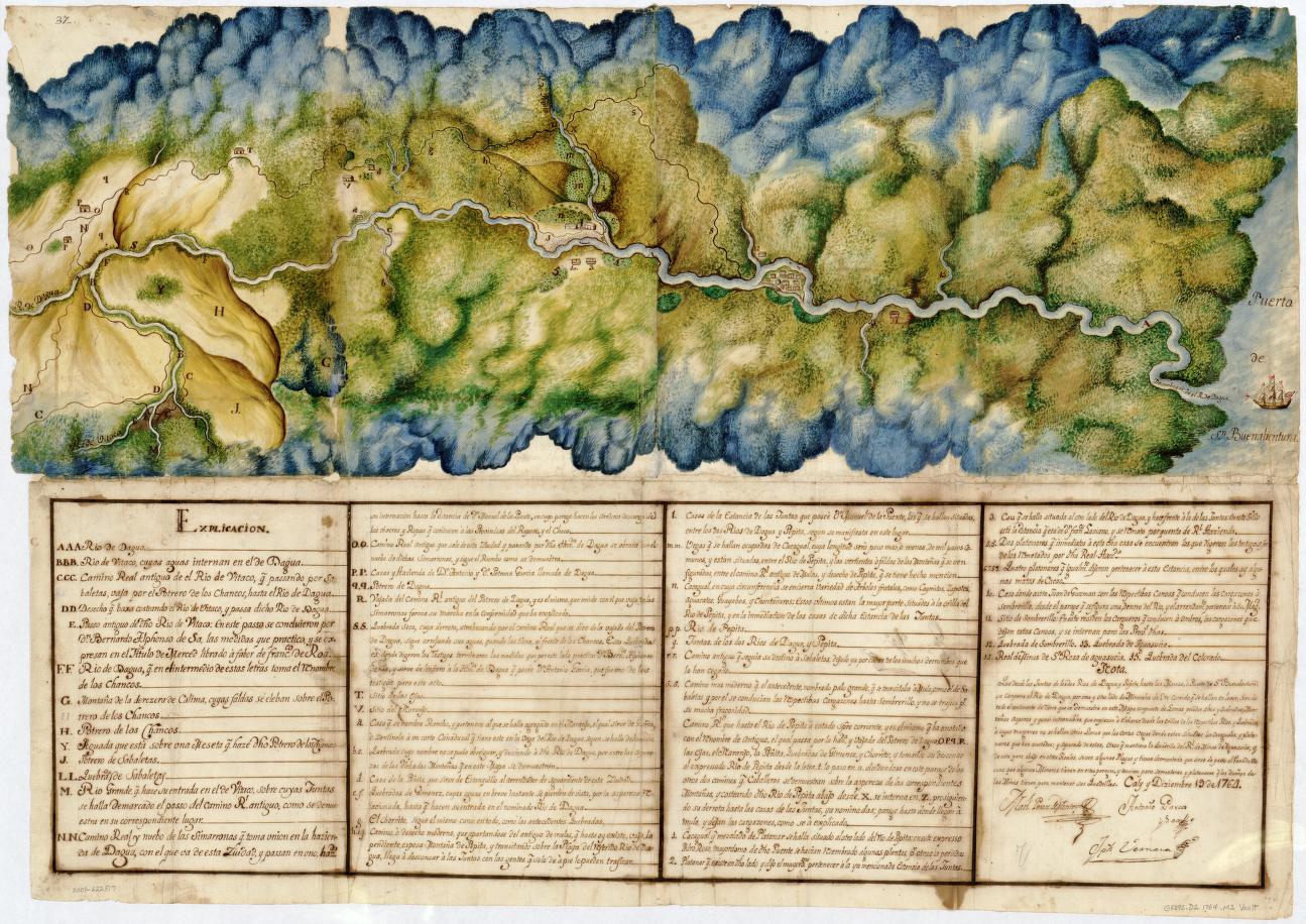
A hand-painted map from 1764, tucked away in the Library of Congress, quietly traces the Dagua River’s winding route through Colombia’s gold-laden frontier. This watercolor artifact is more than a navigational tool—it’s a layered document of African resilience and ingenuity at the edges of the Spanish empire. The map connects the colonial city of Cali to the Pacific port of Buenaventura, revealing not just geography but the hidden networks of trade, resistance, and adaptation that shaped the region. Scientific analysis of its pigments and paper uncovers a global story, with materials sourced from across the empire, stitched together in vibrant color. Each brushstroke preserves echoes of autonomy and survival, mapping out a world where boundaries were as fluid as the river itself. Sometimes, history’s most revealing journeys flow quietly between the lines. #ColombianHistory #ManuscriptMaps #CulturalHeritage #Culture
2025-06-18
write a comment...